Abstract.
(Unpublished PhD thesis, University of Edinburgh, 2004)
This thesis develops a chronology of jökulhlaup (glacier burst flood) activity from Mýrdalsjökull in southern Iceland. Throughout the Holocene, the interaction of the volcano Katla and the overlying ice cap of Mýrdalsjökull have triggered many jökulhlaups. Crucially however, our knowledge of the possible flood routes is incomplete. Flood activity to the south and east of the ice cap has been well constrained from historical and geomorphological studies, but routes to the west of the ice cap have not been fully investigated. This is important for understanding the interaction of Katla and its overlying ice cap as well as from the perspective of hazard assessment.
New geomorphological, sedimentological and tephrochronological data have identified 15 flow events during the Holocene. The majority of these were hyperconcentrated flow events originating from, or close to, the northwest area of the ice cap and are associated with subglacial volcanism. One flood originated in the Veiðivötn area and on 3 occasions flooding from Katla may have been accompanied by floods from Eyjafjallajökull. A further two events relate to re-mobilisation of thick airfall tephra deposits. Silicic pumice found on the sandur and close to the ice margin indicates that the Markarfljót acted as a terrestrial transport route for pumice found along North Atlantic coasts, and was possibly a route for silicic Katla jökulhlaups. Additionally, flood routes and glacial landforms show that Entujökull reached a maximum Holocene extent in the mid-Holocene, extending further downvalley than during the Little Ice Age.
In prehistory, floods were directed to both the south and west of Mýrdalsjökull. Similarly timed jökulhlaups took these paths when floods also flowed from Eyjafjöll into the Markarfljót. This suggests that concurrent routing of floods to the south and west of Mýrdalsjökull is related to synchronous volcanic activity in Katla and Eyjafjallajökull. Since the 10th Century most Katla floods have been routed to the south east, possibly reflecting changes in intra-caldera eruption sites or subglacial topographic change associated with the Eldgjá eruption in c.935 AD, as suggested by Larsen (2000).
The environmental impacts of these floods were significant. Late prehistoric and early historic floods had a major role in shaping the landscape faced by the earliest Norse colonisers of the region. Future flooding could pose a distinct hazard to farmland downvalley and to popular tourist areas in North Þórsmörk.
Please refer to this abstract as: Smith, Kate T. (2004) Holocene jökulhlaups, glacier fluctuations and palaeoenvironment, Mýrdalsjökull, South Iceland, Unpublished PhD thesis, Institute of Geography, School of Geosciences, University of Edinburgh. Feel welcome to contact me about the project. I am preparing manuscripts for publication of the results from this work. Publications and presentations to date on this subject are listed below.
skip to main |
skip to sidebar
Kate Taylor Smith, Postdoctoral researcher, University of Iceland, kate@raunvis.hi.is
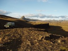
Jo in Tröllagjá, Markarfljót
Welcome
Hello and welcome to my Katla research page. Here you can find information about my PhD research and related more recent work as well as links to institutions and people also working in this field. For more information about me and my other research work please see my main research page.
My PhD work was carried out in the Geography department at the University of Edinburgh and was funded by the UK Natural Environmental Research Council. Please feel very welcome to contact me about my research work at kate@raunvis.hi.isMy Katla research
- PhD abstract (1)
- Related publications (1)
Katla and Mýrdalsjökull links
Funding links
Thanks
.. to my PhD supervisors David Sugden and Andrew Dugmore, to Anthony Newton, Guðrun Larsen and Nick Hulton for invaluable advice and help and my external examiner Hreggviður Norðdahl. Thanks also to my voluntary field assistants